This baseline study supports the ravine management component of the Haiti Municipal Development and Urban Resilience Project in Cap-Haïtien, financed by the World Bank. The city’s location at sea level and its surrounding hills make it highly vulnerable to both fluvial and coastal flooding. These risks are intensified by climate change, deforestation, and unregulated construction. JESCA Solutions was engaged to document pre-intervention conditions across seven targeted sites along the Belle Hôtesse and Zétrier ravines. The study provides environmental, social, and spatial reference points to support the monitoring and evaluation of future flood mitigation works and resilience outcomes.
Activities
Conducted a review and analysis of project documentation and engineering plans to guide the baseline scope, with a focus on flood risk exposure, infrastructure vulnerability, and planned interventions across the seven ravine sites
Designed and applied structured observation tools to assess the condition of ravine banks, ravine beds, and surrounding flood-prone areas under three weather conditions: dry periods, during rainfall, and post-rainfall. A total of 21 field observations were conducted across the seven lots
Trained a multidisciplinary field team in ethical data collection, context-sensitive engagement, visual documentation, and geo-referenced note-taking techniques
Captured and processed visual data, including aerial imagery using a YUNEEC Typhoon H H480 drone and ground-level photographs. All images were geo-tagged to support spatial analysis, monitoring, and comparative assessment of environmental changes
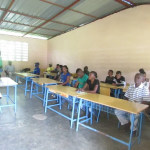
Conducted eight focus group discussions and six key informant interviews with local residents, civil protection staff, municipal officials, and community leaders to gather insights on the lived impacts of flooding and expectations surrounding the project
Integrated all field data with mapping and flood risk modeling using GIS tools to support spatial analysis of flood-prone zones. Developed a comprehensive baseline report that includes mapped visuals, risk zone classifications, and reference points to inform mid-term reviews, implementation monitoring, and final project evaluation